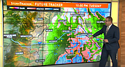
VIDEO: Rain all day today; snow possible later in the forecast

A lot of everything weather wise expected this week. It all begins with a cool down and more rain Tuesday. Temps will stay in the low 40s all day with an all day rain as a cold front is crawling past eastern Washington. Rain will become scattered around Wednesday morning with a small chance for a rain/snow mix.
Before our next storm system, conditions will be drier, but colder for Wednesday and Thursday. Particularly Thursday morning low temperatures will easily be in the 20s across the Inland Northwest. mainly low- to mid- 20s, marking the coldest weather of the season so far.
A major storm is going to hit the PNW Thursday night into Friday. This looks to be mainly an atmospheric river event with heavy rain and high winds. But before temperatures climb to around 50 on Friday, a wet and slushy Friday morning snow is looking more likely on the latest computer models. Any snow that falls melts by the afternoon as the rain continues to fall. But most importantly, Friday is a windy day. Wind gusts are forecast around 50mph which would put us in Wind Advisory criteria and could cause light tree damage and some power outages.
Early next week, more snow is looking likely. While it's a rain/snow mix for Sunday, with highs temperatures in the low 30s on Monday, accumulating snow may stick around early next week.
Video
Rain and colder temperatures to start November
The Inland Northwest will see rain and colder temperatures to start the month of November