Shoshone wildfires create smoky conditions

The July 7 overnight thunderstorm system that moved through the Idaho Panhandle and surrounding area seems to have been the unofficial start of wildfire season in the region.
"Due to record temperatures and drought conditions, the forest saw an unusually high number of lightning-caused wildfires," Idaho Panhandle National Forest Public Information Officer Kary Maddox said.
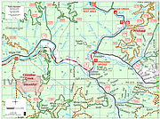
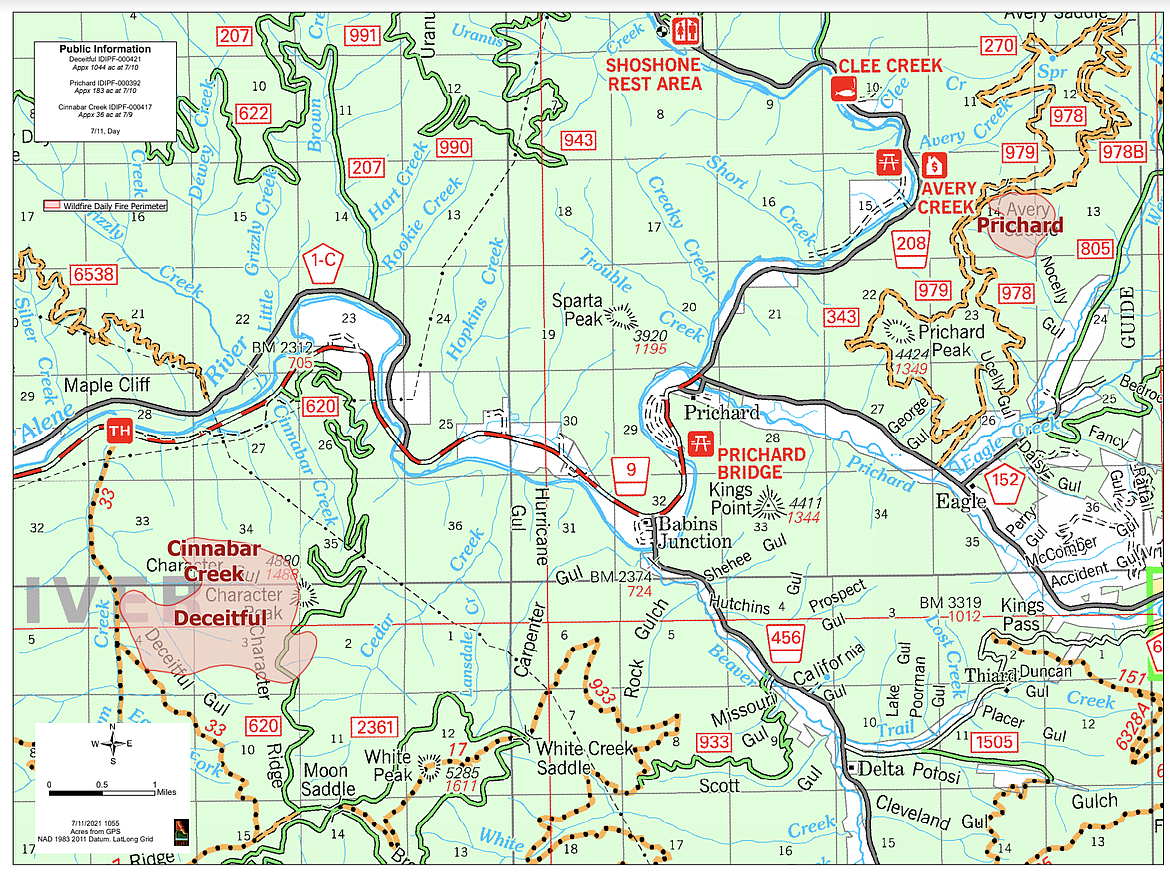
As of July 12 at 4:30 p.m., there are approximately 22 active wildfires burning within Shoshone County, with the largest being the Deceitful Fire at 1,100 acres burned southwest of Prichard and the Tumbledown Fire at 715 acres burned 30 miles east of Avery. All the wildfires are currently being managed by crews from the U.S. Forest Service and/or Idaho Department of Lands.
According to IPNF Public Information Officer Sharla Arledge, the Deceitful and Cinnabar Creek fires merged late Saturday afternoon due to high winds and ran east. The Prichard Fire also grew during that same time frame and as a result, these three fires have now been grouped together as the "Character Complex."
The North Idaho Type 3 Incident Management Team has command of this Complex. Weather and fuel conditions along with strained resource availability have and will continue to hamper fire management operations.
There are approximately 130 personnel assigned to the Complex. These resources include a heavy equipment task force, two dozers, one excavator, one water tender and three hand crews.
On Monday, A Type 2 Management team was briefed and plans to take command by Wednesday morning.
On the Deceitful Fire, equipment is being used for improving road access for water tenders and engines to be utilized for an indirect attack. Managers are also keeping a close eye on the proximity of the fire near BPA and Avista power lines.
For the Pritchard Fire, all assets are being used for both direct and indirect attack.
Ground resources with the help of aviation resources are being utilized for the progression of containment lines. A structure protection plan is being assessed for the West Fork of Eagle Creek. IPNF asks that motorists avoid unnecessary travel near the 978, 978B, 979, 343, 620 roads for firefighter access, heavy equipment and suppression efforts.
IDL Fire Warden Chris Myers reports that The Graham Ridge fire is approximately 90% contained and that mop up activities will continue while the condition of the fire continues to smolder. Two handcrews, five engines, and two water tenders are being utilized.
The largest fire in the southern part of Shoshone County is the Tumbledown fire. Maddox states that it is burning on steep terrain, resulting in rocks and debris causing unsafe conditions and rendering the St. Joe River Road impassible near mile marker 68.
Alternative access to the upper St. Joe River area is over Gold Pass. The Little Joe Road (FS 282) from I-90 at St. Regis, Mont., connects with highway 50 at Gold Pass (the ID/MT state line).
Due to the multiple nearby fires, air quality in the Silver Valley has fluctuated between "moderate" and "unhealthy for sensitive groups." To see the live air-quality map, visit https://airquality.deq.idaho.gov/home/map.
The following are the major active wildfires in Shoshone County broken down by zone, name, and acres in size as of Monday at 4:30 p.m.:
Central Zone(northern Shoshone County)-
• Deceitful, 1100
• Bald Eagle, 3.2
• Prichard, 183
• Cinnabar Creek, 4
• Graham Creek, 15, 90% contained
South Zone (southern Shoshone County/St. Joe region)
• Tumbledown, 715
• Dolly Creek, 60 acres
• Simmons Ridge 1, 45
• Simmons Ridge 2, 35
• Devils Pulpit, 25
To date, there are 32 total fires on Idaho Panhandle National Forests (IPNF) protection and/or ownership. As incidents develop, information including maps, closures, and photos will continue to be posted to https://inciweb.nwcg.gov.