Officials speak on Character Complex fires
KELLOGG — The fires that make up the Character Complex wildfires that are burning north of the Silver Valley continue to slowly grow as fire crews work around the clock to limit their spread.
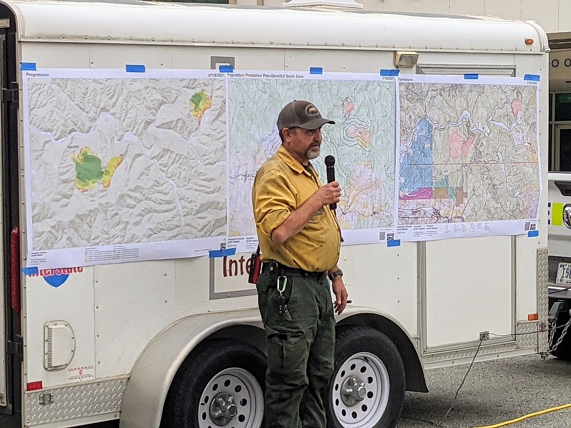
Community leaders and fire officials gathered to inform the public about the fire's progress Monday night at the Kellogg High School parking lot.
Speakers including District Fire Manager/Operation Section Chief for Northern Rockies Team 3 Sam Gibbons and Shoshone County Sheriff Mike Gunderson walked those in attendance through firefighting operations and evacuation precautions that have been put into place.
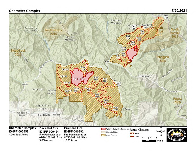
Responsible now for burning over 4,000 acres of combined mountainous forest land and lowering the Silver Valley's air quality to sometimes unhealthy levels, the Deceitful and Prichard fires (together making up the Character Complex) have been causing all sorts of havoc in Shoshone County since the July 7 lightning storm.
The largest of the two complex fires, the Deceitful Fire, has burned approximately 3,068 acres of land roughly 7 miles southwest of Prichard and remains 0% contained as of July 19.
The fire continues to burn in heavily timbered, inaccessible areas- making direct attacks by ground crews difficult.
"This fire, we had to back off," Gibbons said of the initial attack. "With the fuel conditions and terrain, we just couldn't directly put people on that piece of ground."
West of the fire area, crews are constructing indirect fire lines from Graham Mountain north to the North Fork Coeur d’ Alene River. Fire crews with masticators and dozers are improving an indirect line along the trail system from Graham Mountain eastward towards White Creek Saddle.
On Monday, crews made good progress on the indirect line along the 933 Road to Beaver Creek and the contingency line further to the south. The north and south structure protection groups are assessing private properties including in the head of Montgomery Gulch, and remain alert for any new fire starts.
The smaller Prichard Fire, which has burned 1,233 acres of land roughly 5 miles northeast of Prichard, is 5% contained. Gibbons explained that significant progress has been made on the Prichard fire, as crews were able to attack it with both direct and indirect strategies — including implementing several successful burnouts.
"We've basically got a control line around the whole way around...this fire is looking good."
As the fire continues to back downhill toward the West Fork of Eagle Creek, a task force with two Type 1 Hotshot crews and two initial attack crews have worked to successfully accelerate line construction and overall containment on the north side from the Avery Saddle toward the West Fork.
Heavy equipment is being used to re-open and reduce fuels along existing roads near the fire’s western and northern perimeter, working toward the Bobtail Fire burn scar. Additional, heavy equipment is expected to assist with strengthening the northern indirect line.
The structure protection group continues to prepare properties in the Eagle Creek drainage with hoselays and water pumps should they need to defend boundaries. Structure patrols have and will be visible in the northern portion of the North Fork Coeur d’Alene River corridor, including Beaver Creek drainage.
The Shoshone County Sheriff's Office announced Monday evening that residents within the Coal Creek – Prichard Zone are now in “Set” status and should consider moving trailers and recreational vehicles out of the area. Residents on Eagle Creek and West Fork Eagle Creek Roads remain in “Set” status. SCSO has also placed a Level 2 or "SET" evacuation status for milepost 12 CDA River Road to Babin’s Junction at milepost 22 (the Coal Creek to Prichard Zone).
For more evacuation information, contact the Shoshone County Sheriff’s Office and refer to the InciWeb page for more details.
Sheriff Gunderson explained at the Monday night meeting that they have prepared a population protection plan for both fire areas, identifying potentially impacted properties and various evacuation stages if the fires continue to spread.
Road, trail, and area closures are in effect on Idaho Panhandle National Forest lands around the fire areas. The closure order and a map are posted on InciWeb and on the Idaho Panhandle National Forest Facebook page. The Shoshone County Sheriff’s Office has closed the following roads: Eagle Creek Road, Montgomery Ridge Road, and Bobtail Road at Prichard Creek for the safety of private landowners and firefighters working in the area.
There is a Temporary Flight Restriction (TFR) over the fire area. For the safety of aerial resources and firefighters on the ground, fire officials ask residents to not fly unmanned aircraft (drones) in the fire vicinity.
For public and firefighter safety, watch out for fire traffic and decreased visibility due to smoke.


