Clarity from BLM concerning Pine Creek Road region

The section of map comes from the Bureau of Land Management's 2007 RMP/TMP, which is the official document of record for all BLM-managed lands. In the shaded area, you can clearly see where the West Fork Pine Creek Road (pink) ends as it heads into BLM-managed lands and becomes what is considered an unimproved road. You can also see that the shaded section of land is designated for motorized use (except snowmobiles), but only on specifically designated roads, which the section of road between West Fork Pine Creek Road and Middle Fork Pine Creek is not.
Courtesy image

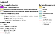
This legend explains the BLM map.
Courtesy image
PINE CREEK –– The curious case of the West Fork of Pine Creek Road has taken another twist as the Bureau of Land Management offered up some answers containing vital information regarding the small section of road.
For a quick refresher on the situation, roughly two weeks ago it was discovered that Pine Creek resident Joe Avery had set up a road block near the “end” of West Fork Pine Creek Road for the second time in the past 13 months.
The gate was an attempt to deter users from driving on the road as it passed through two separate properties, one being owned by the Averys and the other by Hancock Timber Resources before heading into lands owned by the BLM.
After being torn down and the reset, Shoshone County officials told Avery that he needed to remove the gate as it was in the county right-of-way.
In the weeks since, the debate has circled around who owns that stretch of road beyond where Avery had gated off and prior to entering the BLM lands.
On Shoshone County’s GIS Parcel Information System it clearly shows that the road is separate property from Avery’s and Hancock’s leading right up to Hancock/BLM property line, but there is no set designation as to who owns it.
County officials have looked into the ownership of it as well, but have indicated that their records don’t have any information about the section of road.
Commissioner Mike Fitzgerald told the News-Press that the county hasn’t claimed the road on their annual road’s report, further leading to the conclusion that this section of road simply doesn’t have an owner.
At the heart of the matter is that local recreators have used the road in the past to access a special designated area for off road use, but now feel as though Avery’s gate is simply in place due to him not wanting them to be up there.
BLM Field Manager Ray Pease took a few moments to answer some questions concerning his agency’s interpretation of maps that exist within their Resource Management Plan/Travel Management Plan (RMP/TMP).
The current RMP/TMP is from 2007, and contains the rules and regulations for the vast amount of lands owned by the BLM.
Avery had believed that he had an official BLM map showing that the road from beyond where he has placed his various blockages was non-motorized use only, however according to Pease – the map that Avery had referenced is not a part of the official RMP/TMP.
However, in the RMP/TMP it states that all of Pine Creek Road, from the moment it leaves Pinehurst, is considered a Proposed Federal Land Management Highway (FLMH).
Once the road enters BLM’s land, it then shifts to a designation of “Unimproved Road.”
This is where the situation gets exceptionally sticky, but may also provide a lot of answers.
According to the RMP/TMP, although the Unimproved Road runs through a section of land where the designation for use by motorized vehicles allows everything except for snowmobiles – but only on designated routes.
Where these two roads meet, the FLMH turns into a section of unimproved road that is not considered a designated route.
“In this particular case, the road south of private property is not a designated motorized route, therefore, per the TMP, it is closed to public motorized use,” Pease said. “There are no restrictions on non-motorized use on BLM lands in this area.”
Avery had previously claimed that he was given permission by a former manager with BLM to block the road, but Pease explained why that would be problematic, whether Avery’s claim is true or not.
“The Bureau of Land Management only has authority to manage use of routes on BLM-managed lands and has no authority to define uses on private, county or state roads,” Pease said. “The BLM may obtain easements from willing private landowners that allow for administrative and public access; however, this has not been the case for the Pine Creek Road. The BLM does not have the authority to give private property owners permission to install gates on private lands. Actions on private property are outside the scope of the BLM’s authority.”
In the case of specific easements, Pease claimed that BLM does not have one with Avery on West Fork Pine Creek Road, however they do have one with him on the Langlois Creek Road that connects to Pine Creek Road.
“The Langlois easement grants the BLM administrative use and allows public use of the road,” Pease said. “The easement also specified that the BLM would install a gate (negotiated in the development of the easement) and that the grantor (Mr. Avery) may prohibit public entry or use seasonally and during periods when logging operations or related activities are in progress. Mr. Avery exercises this provision by locking the gate from August 25 to January 1, each year.”
So whereas Avery has one gate legally set up through an easement, his other blockages were placed illegally.
Now, there still is the matter of fact that BLM has designated a specific area south of West Fork Pine Creek Road for off road use however, in terms of what the BLM will and will not allow, Pease was quite clear that there is only one way for them to access that area legally.
“The 2007 RMP (Page 53 Action RC-1.5.7) states that the Middle Fork of Pine Creek Road would specifically be managed for ‘rock crawling’ (extreme 4WD) activities,” Pease said. “This is the only such road designation. The Langlois Creek Road is the designated route that provides access to the Middle Fork Road.”
While this may clear up the picture concerning the surrounding area, the mystery still remains.
Who is responsible for the last half-mile section of West Fork Pine Creek Road?
The Bureau of Land Management is an agency within the United States Department of the Interior responsible for administering federal lands.
Headquartered in Grand Junction, Colorado, and with oversight over 247.3 million acres, it governs one eighth of the country's landmass.